Cycling to French American
There are many reasons to ride a bike to school. It's fun. It's good exercise. It develops a child's sense of independence. It provides quality time together for children and parents. It spares the air.
But if you don't already ride regularly, starting can be intimidating and difficult. This page aims to be a concrete guide to help parents and children at French American International School in San Francisco get started cycling to school.
Quick links: route suggestions to the Oak St campus and the Page St Early Childhood Center.
Basic tips
-
Invest in basic safety equipment and proper bicycle maintenance.
- Ensure that your child always rides with a properly fitted bike helmet. Consult a bike shop.
- If you or your child rides at dusk or after dark, make sure that bikes are equipped with good front and rear lights, and that riders have reflective vests or backpack covers.
- Use reflective ankle bands even during the day: they are easy to carry and very visible because of their continuous up-down motion.
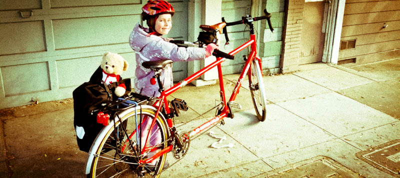
- Consider transporting smaller children (kindergarten and elementary school) with a cargo bike, a tandem, or a trailer bike. A tandem is the most expensive option, but the one that will likely provide the most enjoyment over the years. Mechanisms exist to adapt adult-size tandems to even small children.
- Inspect and tune up the bike on a regular basis.
- Find a comfortable, low-traffic route between home and school. Consider one of the suggested routes below as a starting point. Try riding the route first alone or at a less busy time time of day, before you bike in the morning with your child.
- Arrange a bike commuter pool with other families in your neighborhood. Riding together is both safer and more enjoyable.
- Consider one of the SFBC's bicycle safety workshops. They're free and fun.
- Make cycling a regular thing. Even if you cannot cycle to school every day, designate one or more days every week or month for riding to school, and make them a routine.
Additional materials
The San Francisco Bicycle Coalition is a great resource on cycling with children in our city. Their Youth & Family resources page has many useful links, including pointers to regularly scheduled and free “Family Biking” workshops. They also publish a convenient list of Rules of the Road, as well as the excellent Family Biking Guide, a how-to manual for effective urban cycling from pregnancy to a child's elementary school years.
Bicycle routes to FAIS
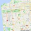
Below is a set of recommended routes from several San Francisco neighborhoods to both the Oak St campus and the Page St Early Childhood Center. Each one links to a high-resolution interactive map and GPS-compatible data. Use them as a starting point to devise your own route.
The sample routes attempt to minimize both climbing and traffic, and they favor low-traffic streets, bike lanes, and separated bike paths. They are appropriate for parents towing their children in bicycle trailers or trailer bikes or carrying them on cargo bikes or tandems. Most are also suitable for children riding their own bikes, though probably not before age 10 and not without some adult supervision.
For the Oak St campus, several routes appear to go the wrong way on one-way streets in the immediate vicinity of the school. Given how busy some of these streets are, we feel it's preferable to walk bikes on the sidewalk for half a block or so, sometimes in the direction opposite to traffic, rather than to ride in the street with traffic.
This list does not cover every neighborhood in the city. Unfortunately, in some neighborhoods, like SOMA, we do not know routes that we can recommend as child-friendly. Please contribute your own suggestions by sending us email.
Routes to the Oak St Campus
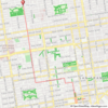
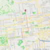
Cole Valley and the Haight →map
Page Street is a quiet way to school. On the return, use Market Street and the “Wiggle” to make the climbing easier.
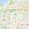
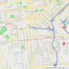
Marina →map
Polk Street to school and Steiner Street home—an effective way to get over the Pacific Heights ridge.
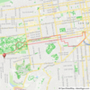
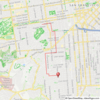
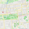
Noe Valley →map
23rd Street is a gentle hill, and Valencia Street has a bike lane the whole way. Traffic lights on Valencia are timed to bicycle speeds (13mph).
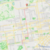
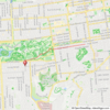
Pacific Heights →map
Steiner and McAllister Streets provide a gentle and relatively low-traffic corridor.
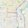
Potrero Hill →map
17th Street and Valencia Street have bike lanes and moderate climbing. Depending on where you live, the last few blocks on Potrero Hill may be a challenge. 18th or 23rd St may be preferable to 17th from some parts of the neighborhood.
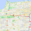
Richmond →map
Through Golden Gate Park and via Page Street to school; Market Street, the “Wiggle”, and the Panhandle home.
Inner Sunset →map
Similar to the Richmond route, but turning south from Golden Gate Park, rather than north.
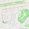
Outer Sunset →map
Admittedly, a long route that requires some dedication!
Routes to the Page St Early Childhood Center
Cole Valley and the Haight →map
Page Street is quiet and direct.
Marina →map
Steiner Street is the easiest way to get over the Pacific Heights ridge, but it's still a big climb southbound. For a longer but less steep alternative, consider riding through the Presidio (Presidio Blvd).
Noe Valley →map
Eureka and Noe Streets help avoid the worst grades.
Pacific Heights →map
Steiner Street is direct and low-traffic.
Potrero Hill →map
17th Street and Sanchez Street have bike lanes and moderate climbing. Depending on where you live, the last few blocks on Potrero Hill may be a challenge. 18th or 23rd St may be preferable to 17th from some parts of the neighborhood.
Richmond →map
Golden Gate Park and Page Street offer a quiet and flat route to school.
Inner Sunset →map
Similar to the Richmond route, but turning south from Golden Gate Park, rather than north.
Outer Sunset →map
A long route, but not much climbing.