King Ridge 400K
part of the SFR Adventure Series
UPDATE: in 2025 the San Francisco Randonneurs are running the King Ridge 400K on June 7. Register here.
The King Ridge 400K is an epic 250-mile clockwise loop with about 20,000ft (6,000m) of climbing. Think of it as the big brother of the Old Caz 300. It takes in all the highlights of Old Caz (though in the opposite direction), and adds Panoramic Highway on Mount Tam, Kruse Ranch, King Ridge (of course!), and Sweetwater Springs. This ride is likely to be among the most memorable of your season.
The climbing starts ten miles into the ride with an ascent of Panoramic Highway on Mount Tamalpais. The grades are moderate and the views can be very fine—though on a foggy day the climb may be a surreal affair of pea-soup fog and condensation falling like rain from tree branches overhead.
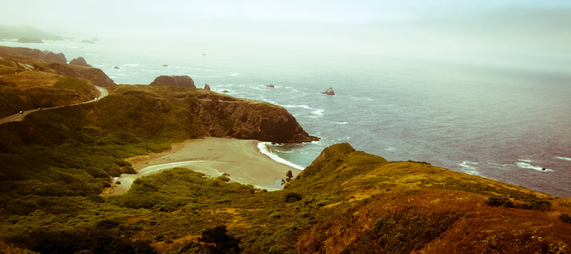
From the summit at Pantoll we drop 1,500ft to the Pacific in just four miles, the graceful arc of Stinson Beach viying for our attention as we negotiate switchbacks. The course then follows Highway 1 for over 30 miles. Bolinas Lagoon, verdant hills in Olema Valley, rollers along Tomales Bay: it's early enough that we ride for miles without seeing a single car. Beyond Tomales, moderately hilly back roads and a short stretch on Highway 1 bring us to the first control in Bodega.
The next 90 miles are the crux of this ride: they include all the unpaved roads and almost all the difficult climbs.
Immediately beyond Bodega, a stiff ascent of Joy Road leads to Willow Creek Road, an unpaved trail through a state park and down to the Sonoma coast. The Old Caz 300K does this stretch in the opposite direction, and it feels surprisingly different: descending Willow Ceek, with its steep grades and loose dirt switchbacks, is a real thrill. Remember to control your speed.
Only a few miles later, that speed is a distant memory: Meyers Grade Road serves up extended stretches of 18% as it climbs from the ocean to 1600ft-high Seaview Ridge. Expansive coastal views and fields of wildflowers reward our labored breathing.
Unfortunately, thick vegetation prevents the later parts of Seaview Road from living up to its name. Soon enough, however, we bear left onto Kruse Ranch Road, an exciting unpaved descent through a rhododendron preserve and back to the sea.
Make sure to stock up on food and water at the Stewarts Point store (control #2, Km 172). The 25 miles to Cazadero have no services but over 3,000 feet of climbing. Long wooded climbs punctuated by short descents lead to King Ridge, where forest yields to wide-open oak-studded pasture. You can see for miles. The road, a narrow one-lane strip of asphalt, snakes along the ridge before dropping steeply to Cazadero.
Now once again we retrace a segment of the Old Caz 300K, fording Austin Creek and climbing on dirt to the top of Old Cazadero Road. Climbing this trail feels easier than descending it, though a couple short stretches may be steep enough to require walking.
A fast, twisty descent (watch for potholes and cracks in the pavement!) brings us to the Russian River, but things don't stay flat for long. In Guerneville we return to the hills and ascend Sweetwater Springs, 3.7 shady miles at a 6% average grade. At the summit, the oak and bay forest opens up briefly to reveal views of Sonoma valley.
At this point the toughest parts of the ride are behind us, and it's almost all downhill to control #3 in Healdsburg (Km 260). Moreover, fewer than 30 miles—mostly flat or rolling, with the exception of the gentle 3-mile climb to Occidental—separate us from Valley Ford and the fourth (staffed!) control.
We return to San Francisco by way of bucolic Marin farm country. Depending on our speed, we may be here at sunset or late at night. On a moonlit night, or at dusk under a full moon, the rolling hills and narrow country roads are magical. Stands of eucalyptus cast dark shadows in the moonlight, and the smell of hay and manure occasionally fills the air.
Wilson Hill is the last real challenge, and then we're in the home stretch. Nicasio, Dixon Ridge, White's Hill—suddenly we're back in civilization. From here it's little more than an hour, most of it on quiet suburban roads, to the finish in San Francisco. Congratulations!